First thing about the book that caught my eye was the hardcover; my old second edition paperback was falling apart. The second thing I noticed was that the editors were the Juviks, Sonia and Jim, both professors at the University of Hawaii at Hilo. That was good enough for me, I carried the big book to the cashier without thumbing through it. I’ve been spending time in it ever since. It is a first-class atlas. More than that, I think it is the finest book in print about Hawaii in general. Whether you want to use it as a reference, as a coffee table book, or as an addition to your Hawaiiana collection, go out and buy this book.
It’s title Atlas of Hawaii, Third Edition is misnomer. Beyond an edition, this is an entirely new book. Unlike the old edition with its long legal size, the new edition actually fits on my bookshelf. The maps, of course, are entirely redone utilizing digital and remote imaging technology. But most impressive about the Atlas is its scope and coverage of topics about Hawaii. It is the first book I can recommend to those who often ask me. “Is there one book that talks about all the fascinating things that make Hawaii Hawaii?” The new atlas does great justice to our superlative archipelago.
Atlas of Hawaii is the work of many people and agencies. The Juviks and the chief cartographer Thomas Paradise are all Hawaii Island residents and geography professors at UH Hilo. The list of contributing authors, over 80 individuals, reads as a who’s who of Hawaiian scholars, scientists, and cultural experts. The writing on various topics is succinct and easy to read. The maps are excellent and numerous, as are the graphs, photos, and tables. The book is split up into five main sections: Reference Maps, The Physical Environment, The Biotic Environment, The Cultural Environment, and The Social Environment. Much of the information includes recent discoveries, theories, and data that until now have only been available in professional papers and publications. Chapter subjects within each section combine to create an eclectic assortment of topics such as Crime, Insects and Their Kin, Culture and the Arts, Atmospheric Change, Evolution, Energy, Recreation, Architecture, Natural Hazards and Alien Species and Threats to Native Ecology. If you’ve got a question about Hawaii, the atlas probably has the answer.
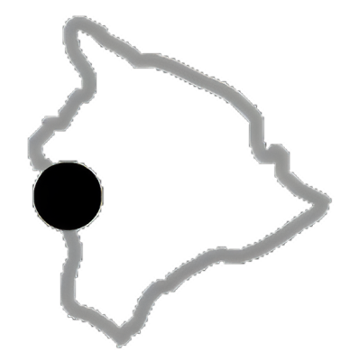
As often happens for me with books, my favorite section of the atlas is the last one-the Appendices. I’ve been looking long and hard for a good Standard to Metric measurement conversion table for everything from miles and kilometers to Fahrenheit and Celsius. There it is on page 302. After the Conversion Table is the Statistical Tables. Want to know how far it is between Hilo and Kailua? The table tells you the distance via Naalehu (125.2 miles) Saddle Rd. (84.3 miles) and Hamakua (91.2 miles). The next two appendices, References and Sources, make up a diverse and valuable bibliography of all things Hawaiian that can’t be matched anywhere else in print. Finally, the Gazetteer (geography jargon for a listing of places) alphabetically lists all the names on the reference maps. It has to be the most exhaustive list of Hawaiian place names in popular print. Did you know that there are nine different geographical features on four different islands all with the name Waipio?
Another feature of the atlas I enjoy is the colored boxes. Interspersed throughout the text within each chapter, these colored boxes contain short essays with graphs and photos or factual lists. For example, within the chapter on history, colored box subjects include “The Sandalwood Trade”, “Whaling”, “The Mahele of 1848”, and chronological lists of “Monarchs”, “Early Heads of State,” and “State Governors”. Other chapters include information on Ethnobotany, Sovereignty, Small Business, Sea Turtles, Polynesian Navigation, and Insect Life in Caves to name a few. Each one is interesting, a quick read, and informative. They make browsing through the atlas a joy.
Hawaii is a place that continually fascinates me. I know I am not alone in this fascination. Hawaii, as the editors note in the introduction, is “one of the most isolated yet populous places on Earth.” Along with the local residents, over six million people a year visit Hawaii because of its unique, enjoyable and special character. Hawaii is a place of superlatives. Superlative in spirit, beauty, and characteristics. Consider that Hawaii has the tallest mountain in the world, the largest mountain in the world, one of the highest lakes, one of the deepest wells, the most active volcano, the most ethnically diverse state in the Union, and the highest life expectancy in the country. The University of Hawaii’s Third Edition of the Atlas of Hawaii is another superlative addition. It is a must have for anyone at all curious about our islands. Read it, peruse it, browse it, study it. If so you will, as the editors hope, discover “the features that make Hawaii a special place.”